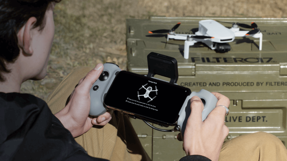
Drones Have Revolutionized Flight—But GNSS Is the Real Hero. Drones have changed photography, videography, and even delivery. But behind every smooth flight and cinematic shot is an unsung hero: the GNSS system. Whether you're flying a Potensic ATOM or any other modern drone, understanding GNSS can make you a better, safer pilot.
How Drone GNSS Actually Works
Satellite Lock-On
- Your drone needs signals from at least 6 satellites for basic positioning
- Optimal performance requires 10–12 satellites (check your controller app)
- Pro Tip: Always check satellite count before takeoff
Trilateration Magic
- Each satellite transmits its location and timestamp
- The drone calculates its distance to each satellite
- By intersecting these distances, it pinpoints its exact position
Assisted Technologies
Most drones (including Potensic models) use a combination of GPS, GLONASS, Galileo, and BeiDou satellite systems.
- Faster satellite acquisition
- Improved accuracy (within 1–2 meters)
- Better performance in open, unobstructed areas
Why GNSS Matters for Your Drone
1. Rock-Solid Hovering
Without GNSS:
With GNSS:
- Position holding within 0.5 m, even in 15 mph winds
- Enables smooth, stable cinematic shots
2. Safety Features
- Return-to-Home (RTH): Auto-returns when signal is lost or battery is low
- Geofencing: Avoids restricted zones like airports
- Altitude Hold: Maintains stable height—perfect for beginners
3. Advanced Flight Modes
- Waypoint Navigation: Pre-program your flight path
- Follow Me: Tracks moving subjects with precision
- Orbit Mode: Captures circular shots around a subject
Troubleshooting Common GNSS Issues
⚠️ Problem: "GNSS signal weak" warning
✅ Wait for more satellites (aim for 10+)
✅ Move away from tall buildings or trees
✅ Calibrate the compass (see guide)
⚠️ Problem: Drone drifting even with GNSS
✅ Check for magnetic interference (e.g., power lines, metal structures)
✅ Update drone firmware
✅ Re-calibrate IMU sensors
GNSS vs. Alternative Positioning Systems
| System | Best For | Accuracy | Limitations |
| GNSS | Outdoor flights | 1–2 m | Open and unobstructed area |
|
Visual Positioning (Optical Flow + Sensors) |
Indoor or low-altitude flights |
0.3 m ~ 5 m |
Only works at low altitude; good lighting and textured ground required |
Note: Potensic ATOM series (excluding ATOM LT) uses both satellite positioning (GNSS) and downward visual positioning, including optical flow and barometric sensors. This enables reliable indoor or low-altitude flight—even without GNSS.
When to Switch to ATTI (Manual) Mode
- Flying in poor lighting or with low surface texture
- Unreliable GNSS signal
- Need for specific cinematic effects
5 Pro Tips for Better GNSS Performance
Pre-Flight Ritual
- Power on your drone on level ground
- Wait until GPS mode is confirmed
Location Scouting
- Avoid “urban canyons” with tall buildings
- Steer clear of high-voltage power lines
Maintenance
- Keep GNSS antenna clean
- Update firmware regularly
Emergency Prep
- Set a safe RTH altitude
- Monitor satellite count throughout the flight
Advanced Trick
- For faster lock-on, face your drone north during initialization
Did You Know?
The Potensic ATOM series combines GNSS with a visual positioning system for ultra-reliable positioning—even indoors or under trees. In open areas, you’ll typically connect to 14–18 satellites. Check this in the flight app before takeoff.
Ready to Master Your Drone?
Explore our GNSS-enabled drones or check out the Beginner's Guide to Safe Flying.
Have GNSS-related questions? Drop them in the comments below!